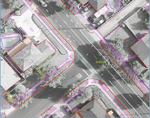
Stereo digitizing is performed on Leica Photogrammetry suite / SSK digital photogrammetric workstations. These workstations utilize Microstation/AutoCAD mapping software, which provides a superior, easy to use, map feature digitizing system for use with stereo scanned imagery. These workstations allow for efficient, accurate data collection while allowing for the ability to easily customize the data to individual client needs (format, layering, symbology.
Feature Collection is the process of collecting non-surface or cultural, terrain features within the stereo-model, such as curb-lines, building footprints, transportation lines, vegetation and the like. All discernible planimetric features are collected and digitized in conformance with each client’s CAD standards for data parameters such as layering, line-weight, line-type and entity color. CGS stereo compilers employ 3D digitizing techniques to trace or pinpoint features. Digitized features are joined visually as well as digitally with no edge match tolerance.
CGS has also capabilities to update, modify and realign old feature data bases in both 2D and 3D environment as per the latest available imagery and any other non-spatial feature attributes like land parcel information, crop and forest species information etc.
Digital Mapping
Softcopy Compilation

